Evolution of Bellingham and San Juan Island Airports and Navaids
November, 2021
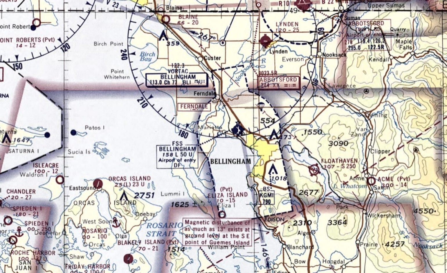
I love history and recently learned that old sectional charts are available online through the Library of Congress. The collection for Bellingham runs from September 1936 through April 1971. During these years, sectional charts were printed with a chart on one side and aeronautical information on the other. Thus, Bellingham had its own chart and adjoined Seattle to the south. Sometime in the 1970s the format switched to charts on both sides and then the Bellingham portion appeared on the Seattle chart. Using the historical charts as a guide, one can trace the evolution of airports and navaids in Whatcom and San Juan counties. A link is attached at the end so you can peruse the collection if interested.
Serious aviation in Whatcom County began in the late 1920s when an airstrip was established in the vicinity of Smith Road and what is now Northwest Drive. It was known as Tulip Flying Field. A few years later, Graham Field became active in the Birchwood area near the current location of Squalicum Creek Park. It was later taken over by the Lind Gravel Company who used the area as a quarry.
October 1929 Dept of Commerce “Airway Bulletin” listing Graham Field
Bellingham sectional, Oct 1938
Here we see Graham field, listed as a Temp Port of Entry along with the recently activated four course radio range located SE of Ferndale labeled “209 JJ RS-KEQH,” 209 KC being the frequency. This did not show on the prior Sept 1936 chart so we assume the range was established in 1937 or 1938. Prior to this there were ranges Seattle and Vancouver. Again, there are several links following which explain how the Adcock or 4 course range operates.
Also noted on this chart are lighted airway beacons. These were used prior to the introduction of electronic navigation, the main impetus being early Air Mail routes. These were a sequential series of flashing lights along an airway route to assist VFR navigation in times of darkness. Just off the south end of Chuckanut Bay – abeam the “R-R Tunnel”- is light #8, portrayed by a star and two arrows. There would be a rotating white light and then a flashing red or green light facing either direction along the prescribed route. These would flash the Morse code identifier for that particular light. Though not shown on this chart, this light would flash - … (B). #9, the next one north flashed - - . (G). #10 at Blaine flashed - - (M). #4 was just north of Tulalip, #5 was at Stanwood and #6 was at North Avon. The letters represented one of 10 letters: W, U, V, H, R, K, D, B, G or M. To help remember the letters and their sequence number, pilots memorized the following: “When Undertaking Very Hard Routes, Keep Direction By Good Methods.”
Typical airway beacon. On display at the Western Antique Aeroplane Museum at Hood River.
In 1940 the WPA began building a single paved runway at the site of the current airport. With National Defense funds, the airport eventually grew to have three runways. The completed airport was opened to the public on December 7, 1941, Pearl Harbor Day. United Airlines began service to Bellingham in 1940, it being a stop on the route from Seattle to Vancouver. Along with increased military use came the need for electronic navigational aids.
August, 1942
In August 1942, there are no other airports nearby and there are none in the San Juan islands. Here, the airway using the BELLINGHAM RADIO range is labeled AMBER AIRWAY NO 5, and we can deduce it serves the route from Boeing Field to Vancouver. Note the “Danger Zone” over Eliza Island. The web link will describe the “A” and “N” symbols either side of the BELLINGHAM RADIO site near Ferndale.
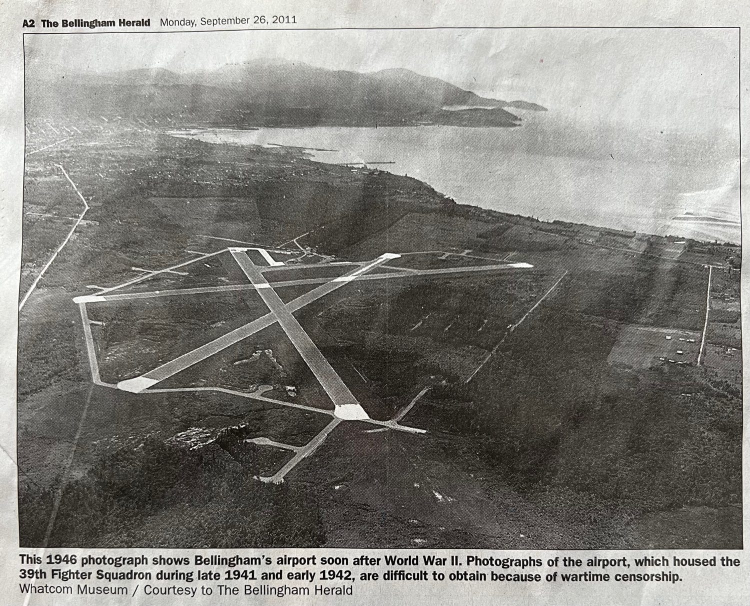
1946 photograph of the Bellingham Airport looking southeast.
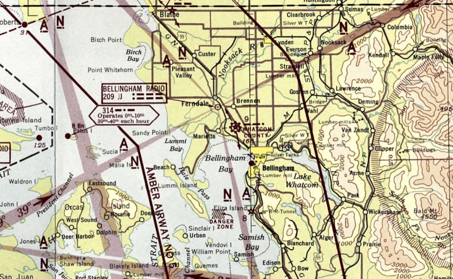
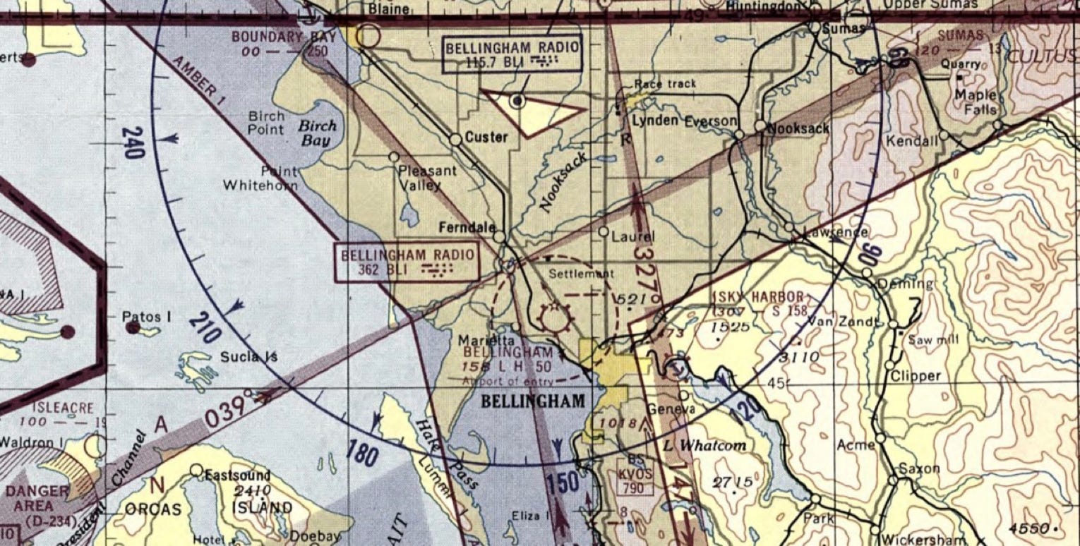
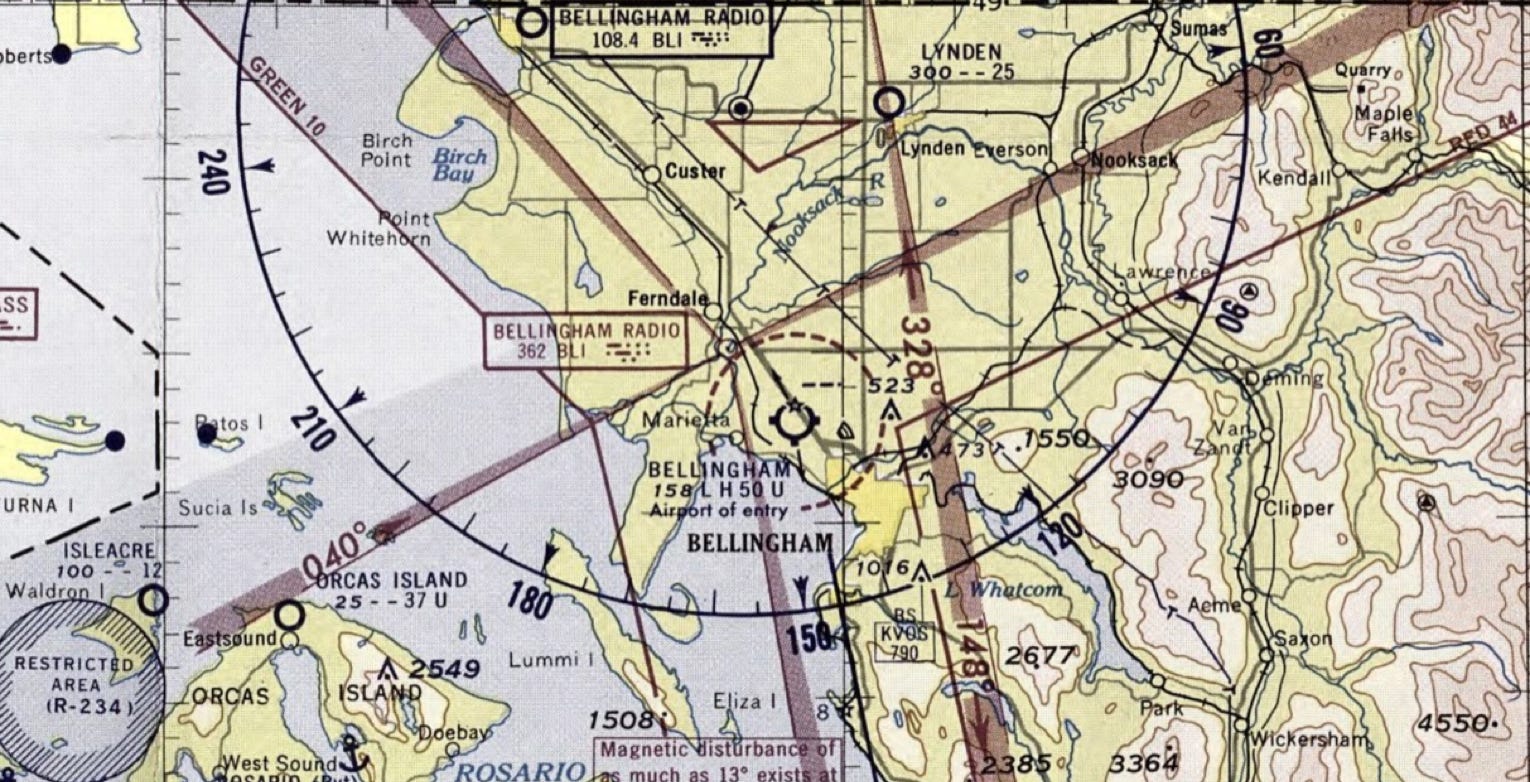
April 1949
BELLINGHAM RADIO had a change of frequency from 209 KC to 391 KC. The first Bellingham OMNI RANGE, 115.7, appears, and in a location just NW of Marietta. There are now unpaved airstrips at Blaine, Sumas and Orcas and there are two seaplane listings on Lake Whatcom, Sky Harbor and Bellingham. 1946 saw the first VHF frequencies listed. The airway beacons are still portrayed at Chuckanut, Bellingham and Blaine. KVOS 790 is portrayed.
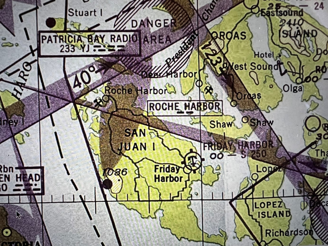
There’s only a seaplane designation at Friday Harbor and Roche Harbor shows a fan marker for the approach at Sidney. It was portrayed for only a few years.
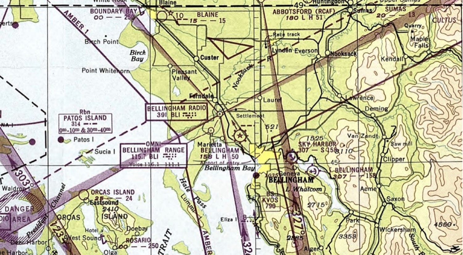
Oct 1951
The BELLINGHAM range is now 362 KC, the BLI VOR has moved to its current location, the Blaine airway beacon is gone along with the second Lake Whatcom seaplane base. Island Acre on Waldron is depicted though East Sound airport is not. The SEA-YVR airway has been renamed AMBER 1.
Back side of 1950 Bellingham Sectional chart.
April 1956
BELLINGHAM NDB 201 KC “BGH” (No Voice) is portrayed north of BLI, Orcas airport portrays “services,” and the first tower on Mt. Constitution is portrayed at 2549’. An airstrip on Speiden, 2100’ unpaved, is portrayed.
April 1959
Lynden airstrip, 2500’ unpaved, is portrayed. A drive-in theater is shown just east of BLI. Sumas airport is gone. BLI VOR is now 108.4. What happened to the BGH NDB? Friday Harbor, unpaved 2400’ is portrayed as is SHEASBY (PVT) 2000’ unpaved on Stuart east.
Close up view of 1950 airport directory on 1950 Bellingham Sectional
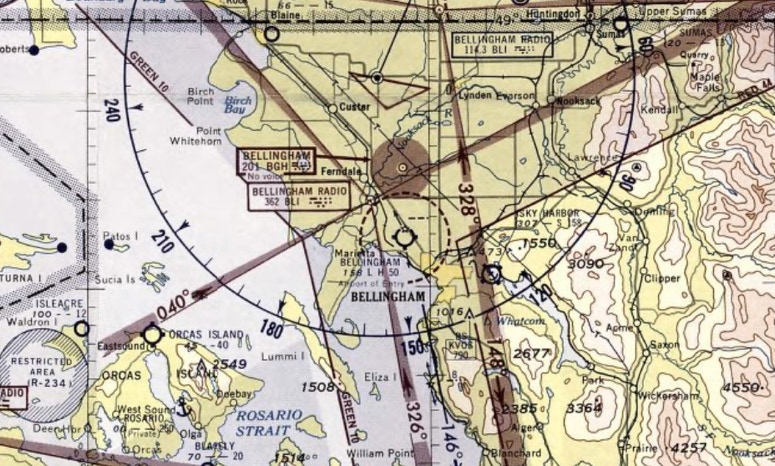
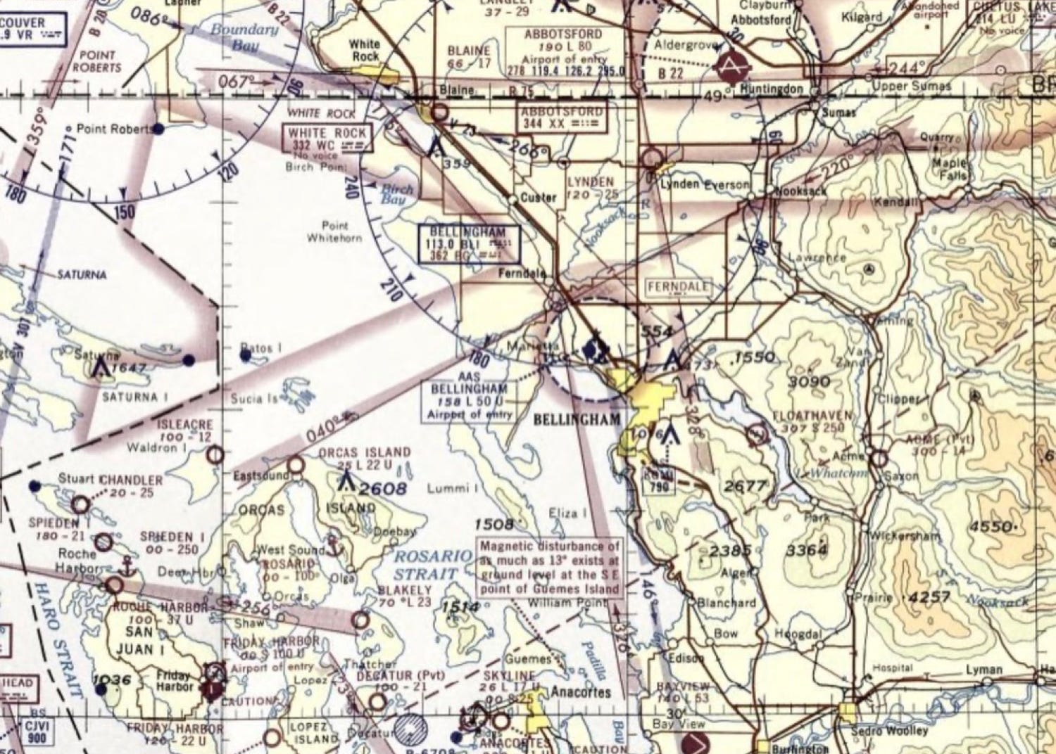
May 1965
BLI now has AAS – Airport Advisory Service - and is portrayed in solid blue. The FERNDALE fan marker is located at the site of the previous BGH NDB north of BLI. KVOS 790 is now KGMI 790, FLOATHAVEN has located on Lake Whatcom and the Abbotsford 344 “XX” NDB is operating – and continues to operates today. The highest tower on Mt. Constitution is now 2608’. Roche has a 3700’ unpaved airstrip, Blakely Island has a 2300’ unpaved airstrip, Lopez 2600’ unpaved and Stuart East has become Chandler, and is now 2500’ unpaved. Friday Harbor is now 2200’ and paved. ACME (pvt), southeast of BLI, shows 1400’ unpaved.
May 1966
BLI AAS is now BLI FSS, the four course “BG” LF radio range has been decommissioned and the Orcas Island airport is now 2700’ paved with a Unicom. The BLI control zone has been extended to the north.
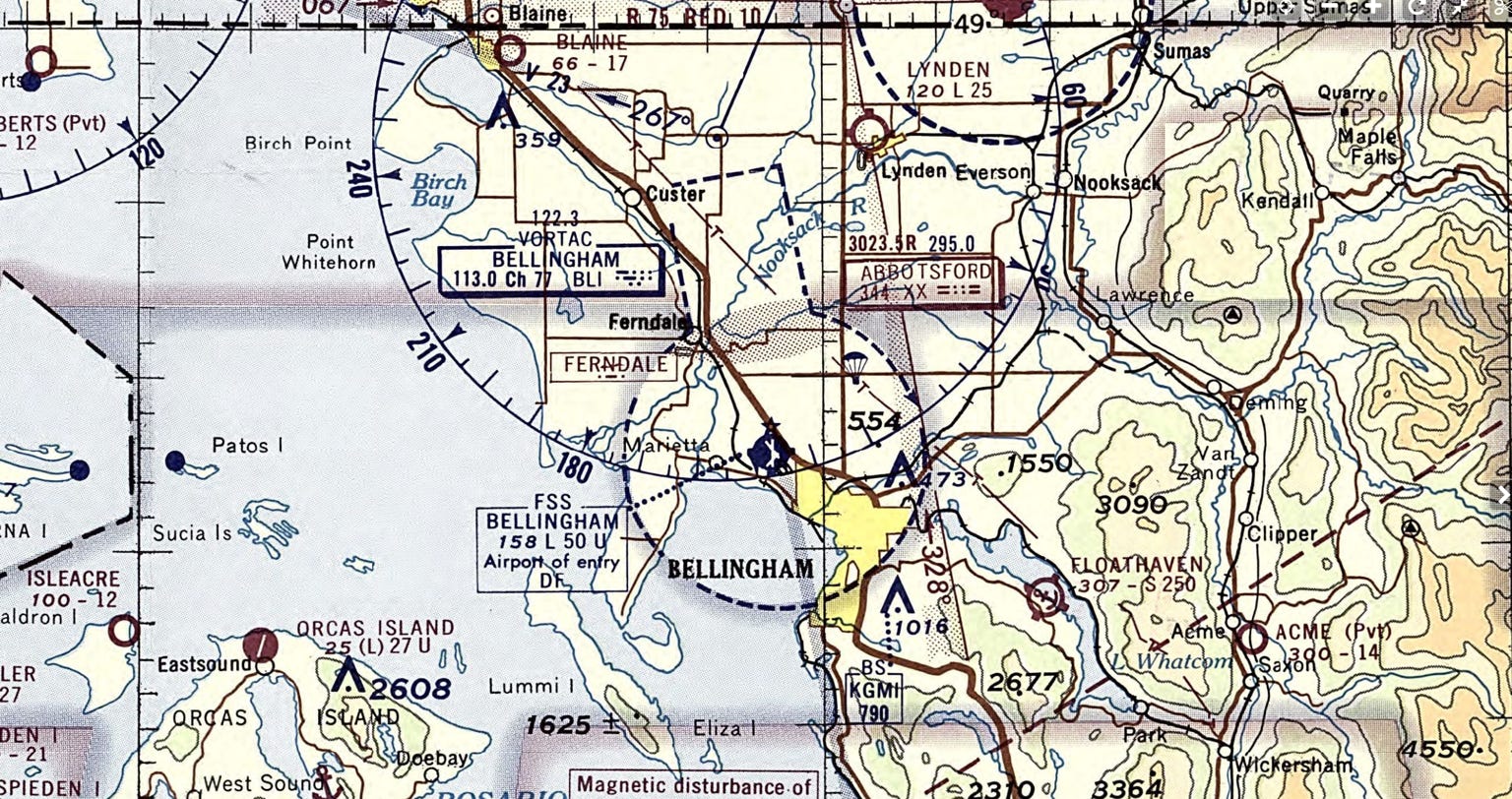
May 1970
BLI FSS now offers “DF” (direction finding) services, Lynden, Blakely and Anacortes are paved, the BLI control zone has been extended south. Eliza Island (pvt) airstrip, 1500’, is portrayed. Parachute jumping is portrayed NE of BLI. Roche shows 4000’ paved as of April 1971.
July 1982
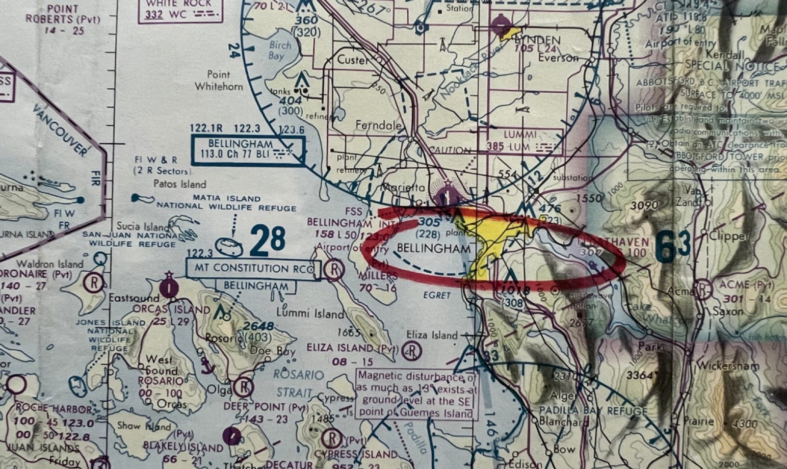
Lummi LUM 385 NDB is located at BLI, Mt. Constitution RCO 122.3 is active. There is a RWY 16 LOC and FSS BELLINGHAM is still in service. AAS freq is 123.6. SEATTLE FLIGHT WATCH 122.0 is available and the BAY VIEW VOR ”BTA” is active on 108.2.
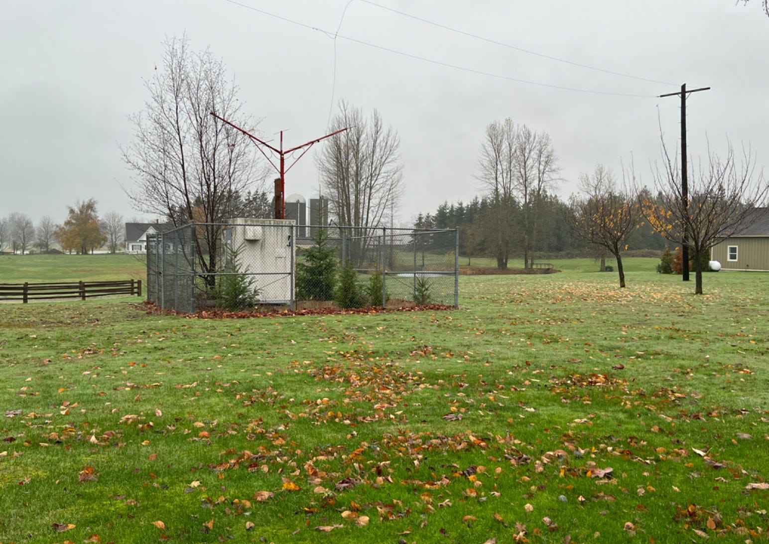
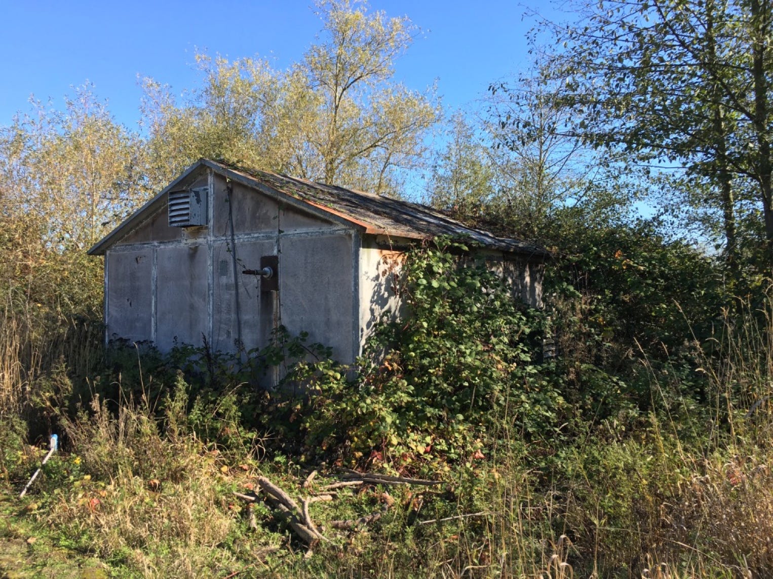
If one is curious, a few remnants of early Bellingham navaids are still visible.
Deactivated FERNDALE fan marker, co-located with the former BGH NDB, corner of Northwest and Wiser Lake Roads.
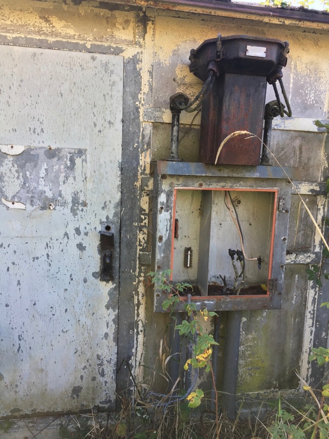
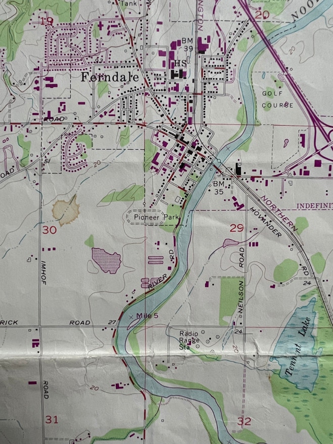
The transmitter shack for the old Bellingham four course range. It’s located just south of Ferndale near the Hovander Farm.
The old transmitter building.
The “Radio Range Station” shows up on this 1952 quad map, about a mile SE of Ferndale near Hovander Homestead.
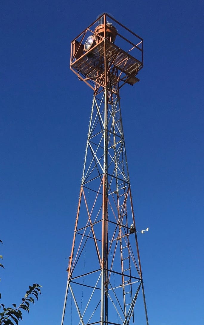
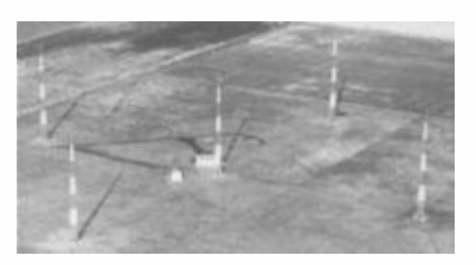
A similar Adcock / Four Course Range
This brings us up to the early 1980s when I arrived in Bellingham and was flying Cessna 402s and Embraers for an earlier version of San Jaun Airlines. There was a LOC 16 approach in BLI and no IFR approaches in the islands. Sometime after I left in the mid-1980s and when PSA and Alaska jet service arrived, an ILS was installed along with a non-federal control tower. Eventually there was an NDB approach at FHR along with a much-lengthened runway. Of course, ORS (then ESD), FHR and BLI now have GPS approaches.