Columbia River Gorge Airway Navaids
Portland Area Airports and Navaids Development
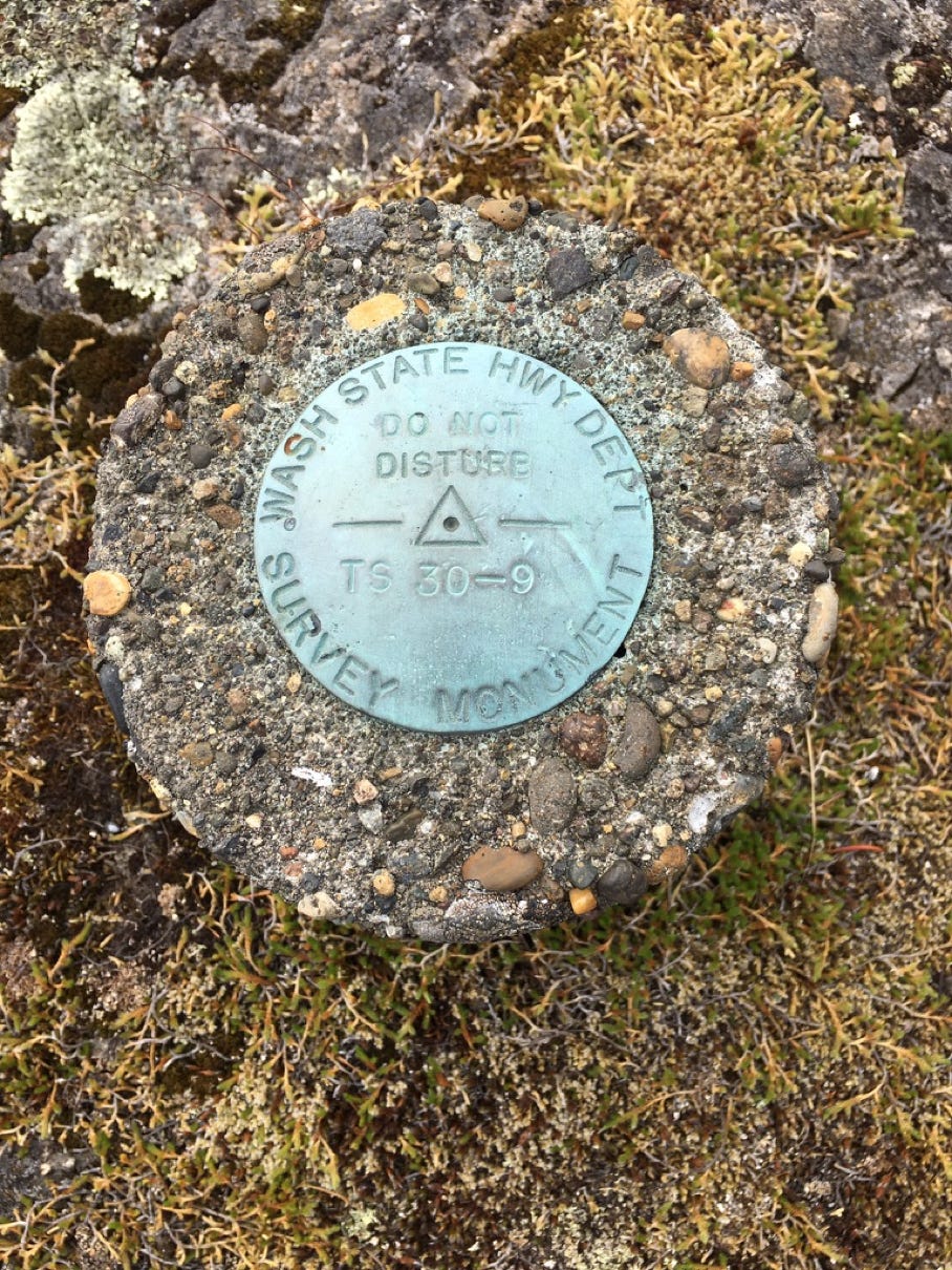
“Weather Station Rock” – Skamania County
December, 2021
In the late 1940s, my uncle Ted Cole, who at the time owned and operated a one-man machine shop in North Bonneville, WA, purchased an isolated piece of property on the Columbia River a few miles east of Stevenson. To the extended family it became known as “Ted’s Rock,” so called due to a large outcropping of basalt on the property, a plug to an ancient volcano. The property was undeveloped and Ted spent nearly 30 years making improvements. He and my aunt eventually moved there after the town of North Bonneville was relocated for construction of the second Bonneville Dam power house in the late 1970s. It was a great place for kids as it had waterfront and trails. The S, P & S railroad ran through it creating the endless anticipation and watching of trains. There was always entertainment and distractions.
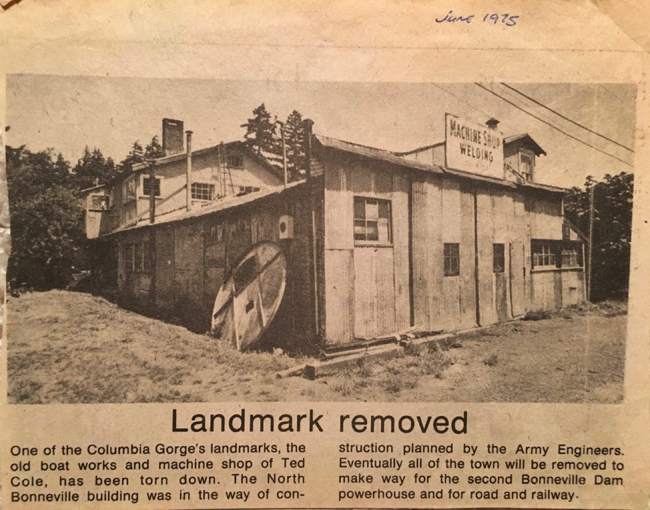
Ted Cole’s North Bonneville Machine Shop. All belt driven.

“Ted’s Rock”
As a youngster in the mid-1950s one item that always stood out to me, on a high bluff overlooking the Columbia with a tremendous view, was a tall vertical wooden pole painted with red and white stripes. Nothing was on the pole, no lights or anything of interest. Whenever I asked what it was, the answer was generally, “Something to do with airplanes.” Airplanes! That made it so much more of a curiosity. Over the years the pole decayed, fell down to the river level and eventually rotted away. But I was always curious.
It wasn’t until a visit to Seattle’s Museum of Flight in 2017 that I reconnected with the “something to do with airplanes” relic at Ted’s Rock. I came across this, mounted under glass in one of the displays:
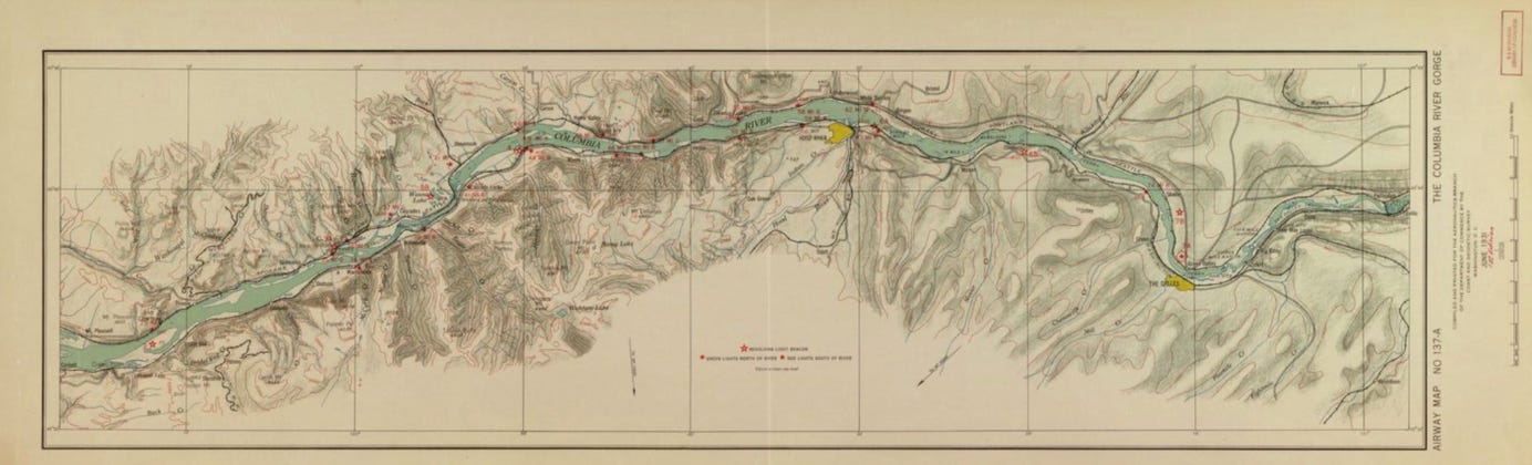
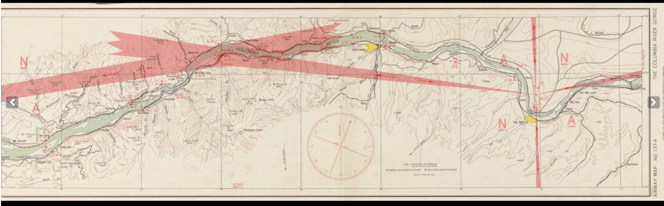
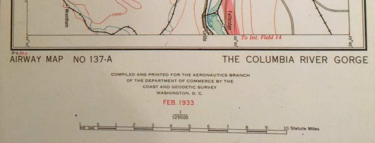
Airway Map NO. 137A – First Edition - June, 1931
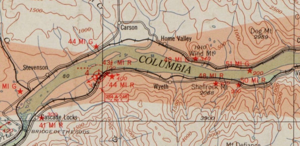
June, 1931. Closeup of “Ted’s Rock” location SW of Carson.
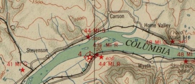
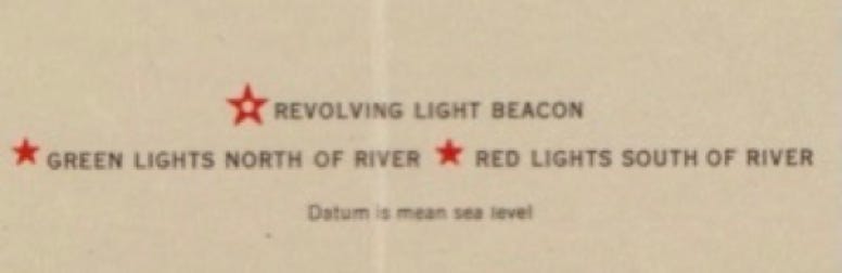
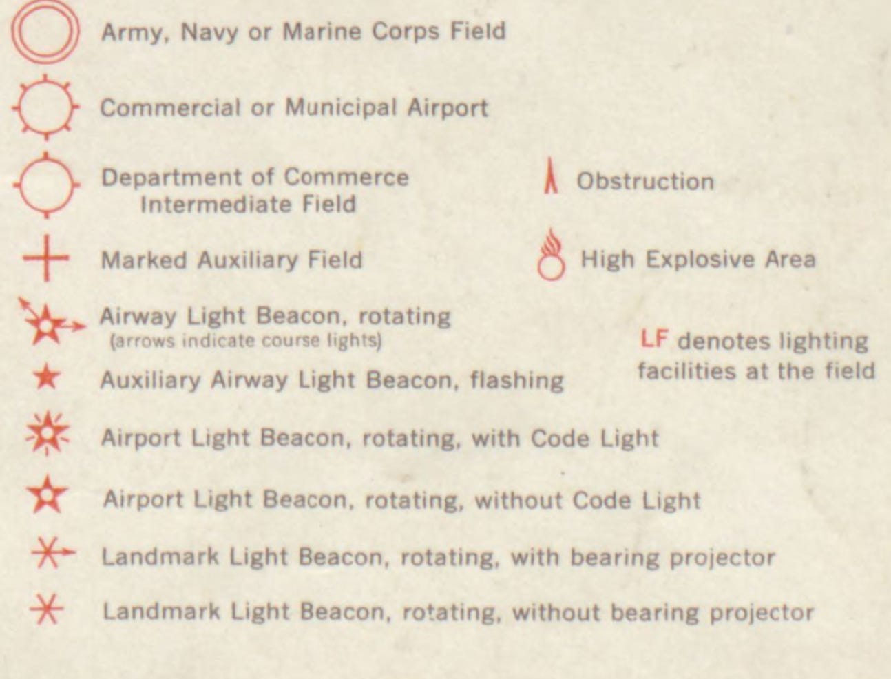
Uncle Ted’s property was about a mile SW of Carson labeled “44 MI G 350” – Mile 44 (from Portland), Green Light, 350’ above sea level. The red star indicates a flashing “side light”. Opposite this light on the Oregon side, east of Cascade Locks at Mile 43 ½, is light #4. The white dot in the star indicates a rotating beacon. Just east of this at Mile 44 is a flashing red “side light.” In 1931 there were no radio navigation aids. Just lights. What also makes this interesting is that it portrays the Columbia River prior to the 1938 completion of Bonneville Dam. There are islands showing in mid-channel. The red circle around the star indicates an “intermediate field,” a landing field which predated the current Cascade Locks airport.
The excerpt below tells about the implementation of the airway lights through the Columbia Gorge starting in 1931.
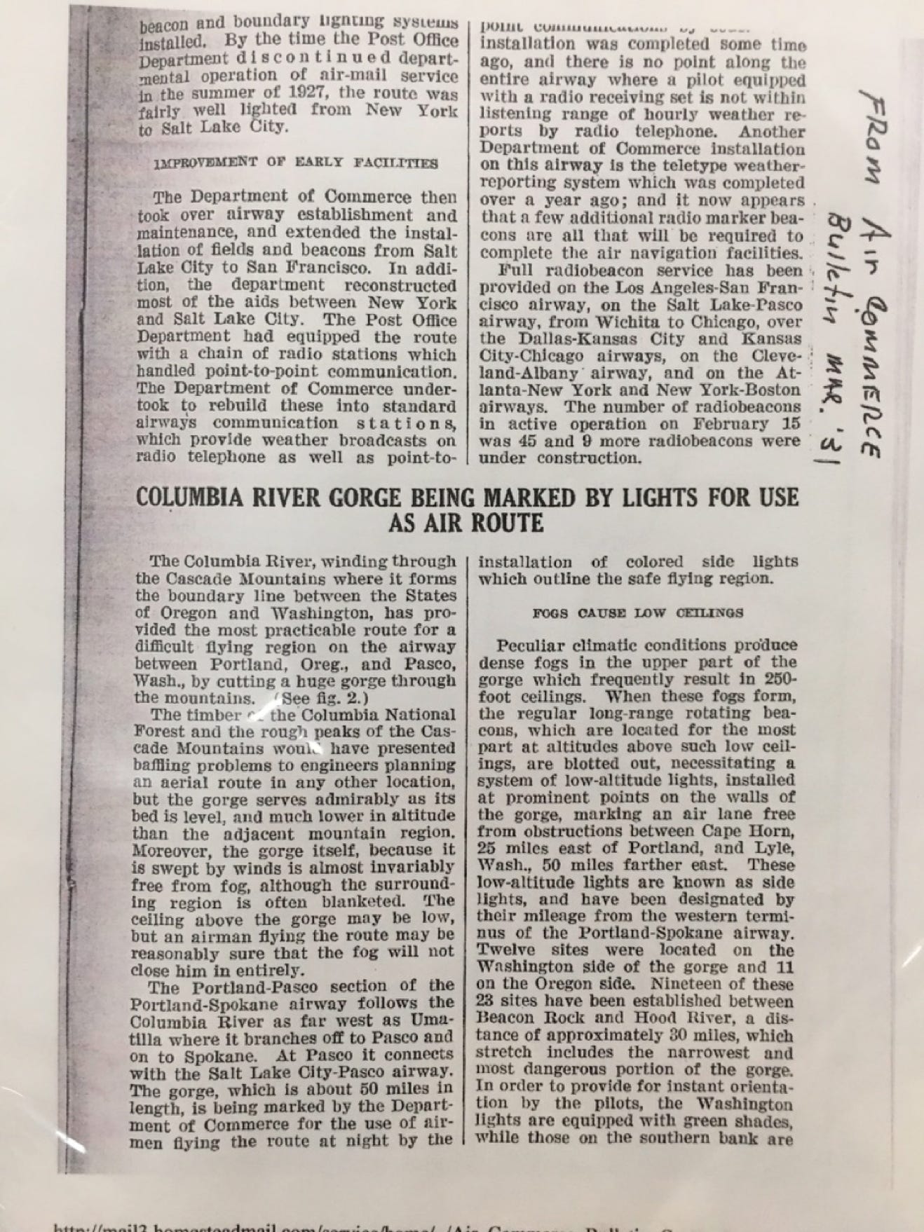
Air Commerce Bulletin - March, 1931
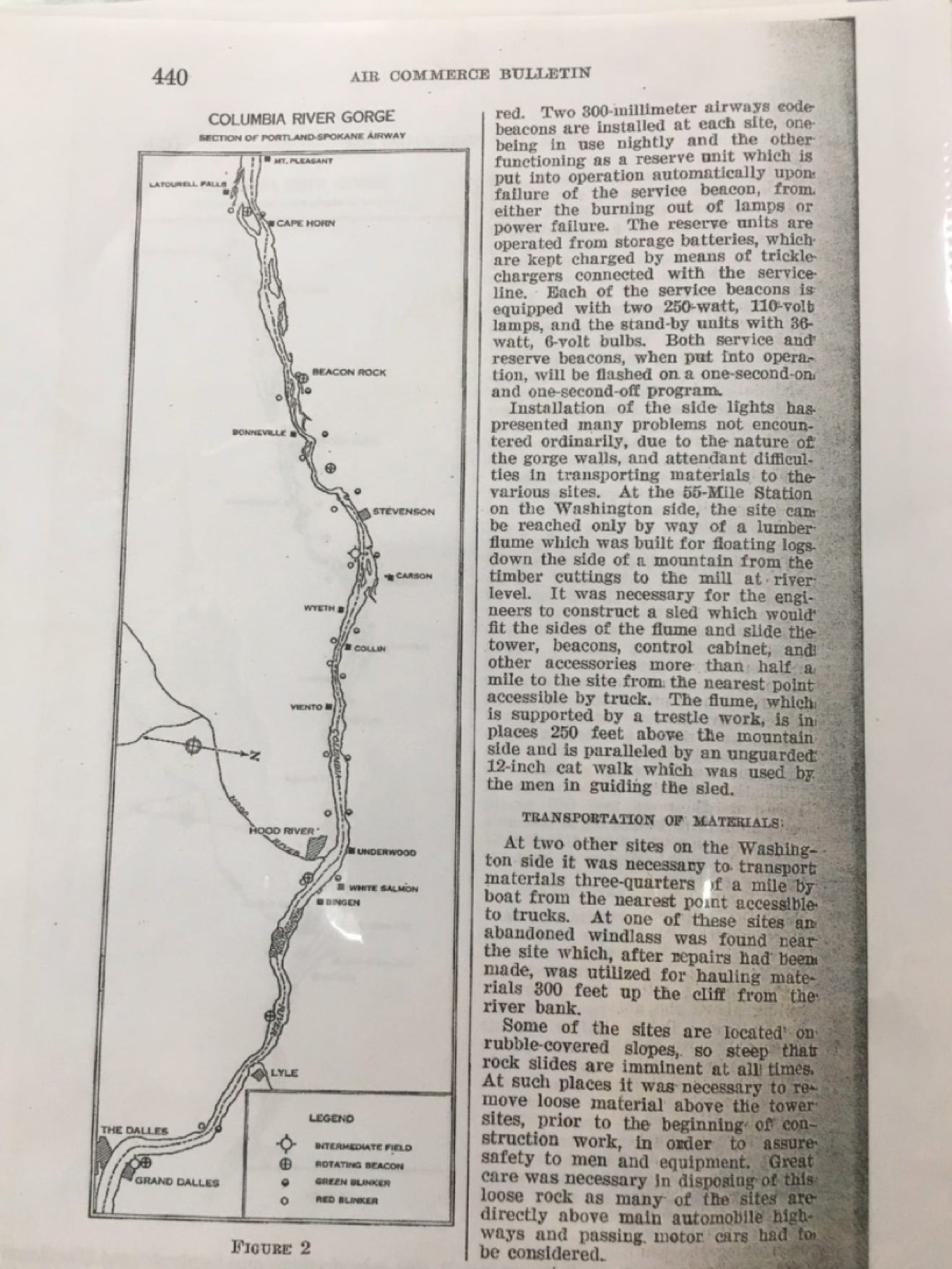

Air Commerce Bulletin – March, 1931. Note reference to “lumber flume.” See photo, below.
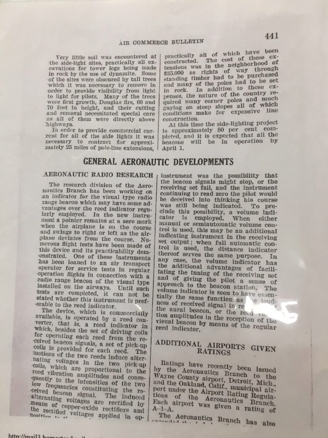
Air Commerce Bulletin – March, 1931
Air Commerce Bulletin – March, 1931
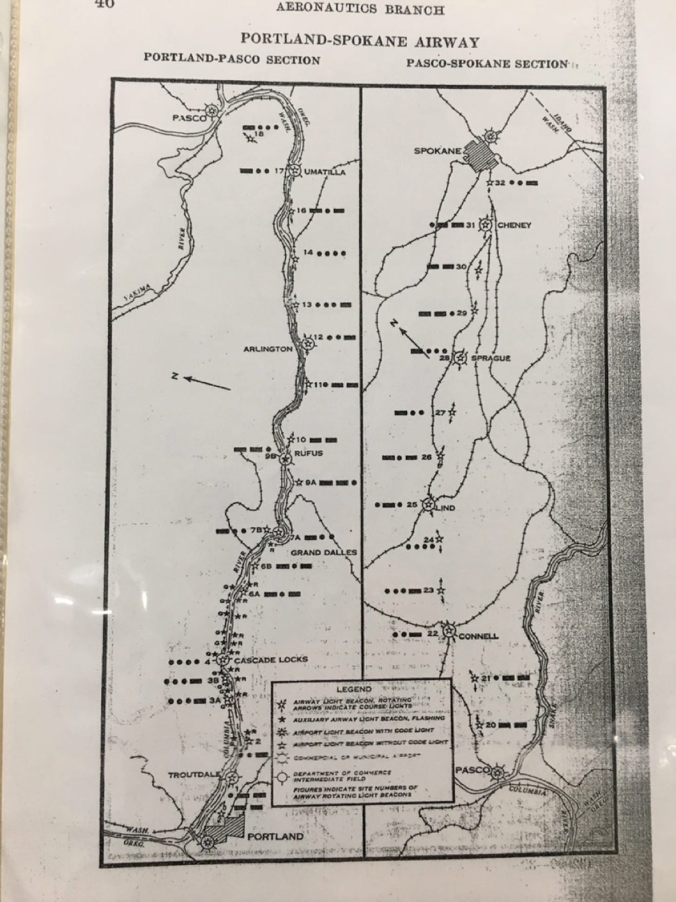
Airway Map No. 137-A, February 1933 Spokane to Portland showing the western portion.
(Map 137 shows the route from The Dalles via Pasco to Spokane.)
Airway Map NO 137-A - February, 1933.
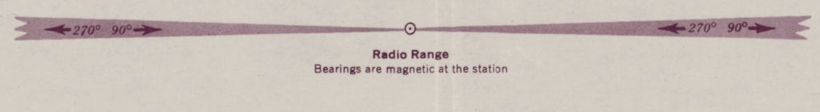
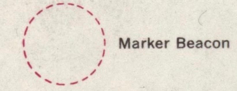
The 1933 edition indicates the addition of Adcock, or four-course radio ranges (shown in magenta), one of the earliest forms of electronic navigation aids. (See link at end of article for how the four-course range operates.) The magenta “feathers” shown on the chart above represent fixed legs from two ranges, The Dalles to the east and Portland to the West. These legs intersect near Anderson Point, just south of Carson on the Oregon side, at mile 44. The dashed circle around the star indicates a low frequency marker beacon, signaling Morse “R” . _ . on frequencies “284 & 248” kc. Planes tracking in a westerly direction from The Dalles would be on the 254-degree leg of the “beam” until this midpoint location, which could be noted by a station passage over the beacon, then begin tracking the 238-degree inbound “beam” to Portland. The circle around the lights, with the difficult to see “LF” designation, shows a lighted unpaved “intermediate landing field.” Subsequent editions label it as CASCADE LOCKS airport.
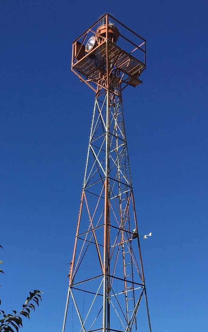
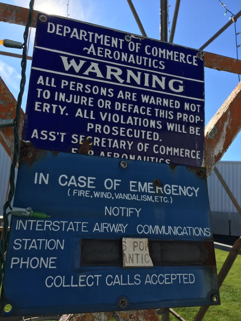
Airway beacon on display at the Western Antique Aeroplane Museum, Hood River, OR. This beacon was originally located several miles east of Cascade Locks at Anderson Point.
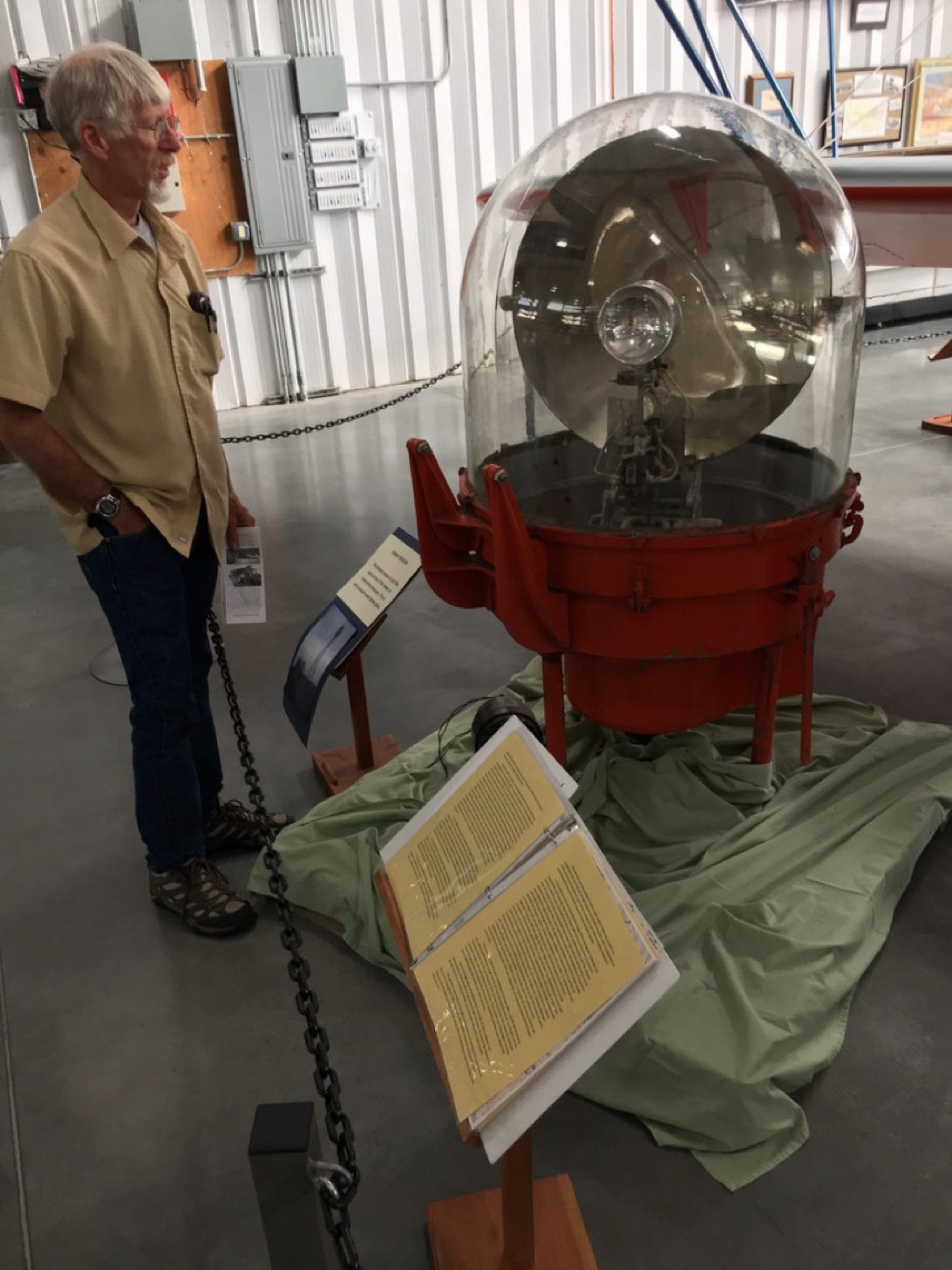
Rotating section of an airway beacon on display at WAAM
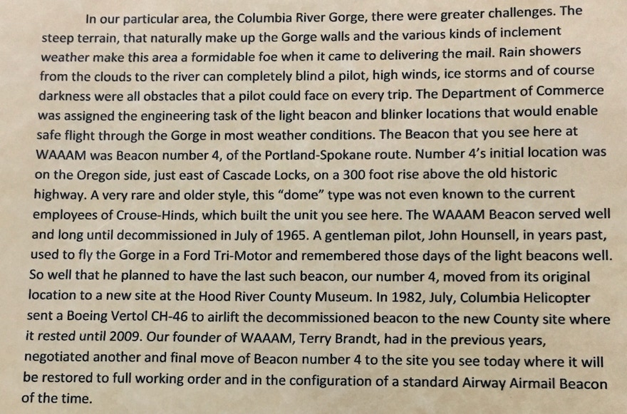
WAAM description of the rotating beacon on display, originally light #4 located at Anderson Point.

In addition to radio navaids, the airway chart portrays lights. As an airplane proceeds along the route, pilots would note at various locations, flashing green lights on the north side of the river, flashing red lights on the south side and at specific locations, a rotating white light and either a flashing red or green light facing in the direction along the prescribed route. These would flash the Morse code identifier for that particular light. The code identifier represented one of 10 letters: W, U, V, H, R, K, D, B, G or M, in that sequence. To help remember the letters and their sequence, pilots memorized the following: “When Undertaking Very Hard Routes, Keep Direction By Good Methods.” In this case, the sequence is followed from west to east.
#0 – Rocky Butte M _ _
#1 – Troutdale W . _ _
#2 – Bridal Veil U .._
#3A – Beacon Rock V …_
#3B – Wauna Lake V …_
#4 – Anderson Point H ….
#5 - (Not Assigned)
#6A – Hood River K ._.
#6B – Mosier K ._.
#7 – Grand Dalles D _..
#8 – (Not Assigned)
#9 - Biggs G _ _ .
#10 – Rufus M _ _
#11 – West Arlington W . _ _
#12 – Arlington U .._
#13 – Heppner V …_
Several makers have an “A” and “B” suffix designation, such as Beacon Rock and Wauna Lake, both being #3 and having the same Morse signal.
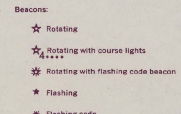
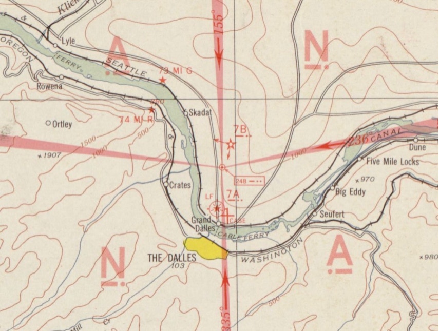
Chart portrayal of The Dalles four-course radio range. See link for a description of how it was utilized for air navigation. Beacon #7B would also have a white rotating beacon as portrayed by star with the white dot in the center. The + represents an unpaved airport named CASE, “LF” showing that it is lighted.
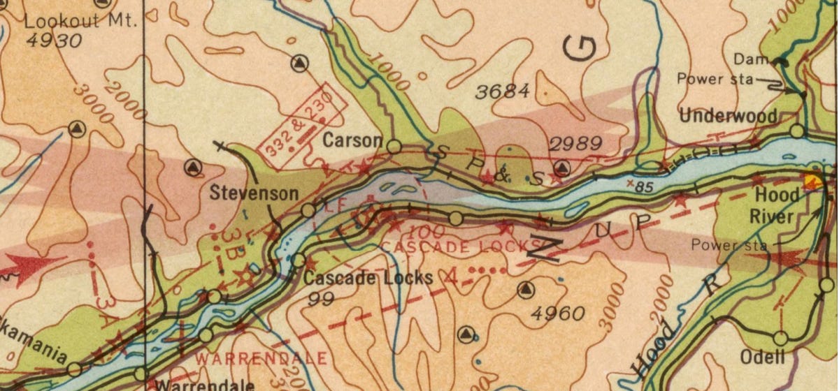
1937. This CASCADE LOCKS airport site predates the current Cascade Locks / Stevenson airport a few miles west of this location. “100” denotes the field’s elevation above sea level. The + at Warrendale represents an unpaved airport. There are several logging railroads near Stevenson.
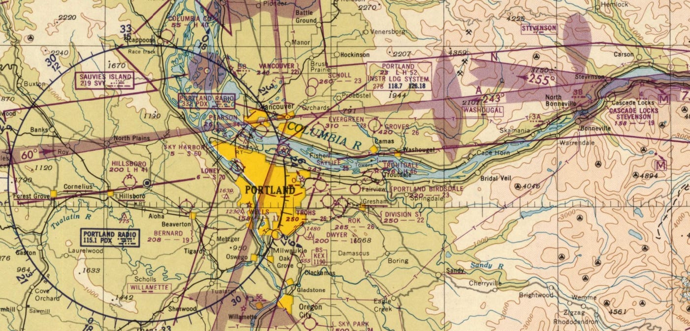
January 1938 – Portland Sectional Chart
The main Portland airport is located at Swan Island on the Willamette River. The Portland four-course range is located at site of the future airport. North of Vancouver on the east side of the Columbia are two airway lights, #58 and #59 for the route between Portland and Seattle. Several miles east of the Swan Island airport is a magenta star with two arrows labeled _0 _. This is Rocky Butte airway light milepost “0” flashing Morse “M _ _” The left / west arrow points to Swan Island and the right one points east to light #1 at Troutdale, then #2 at Bridal Veil and #3A at Beacon Rock.
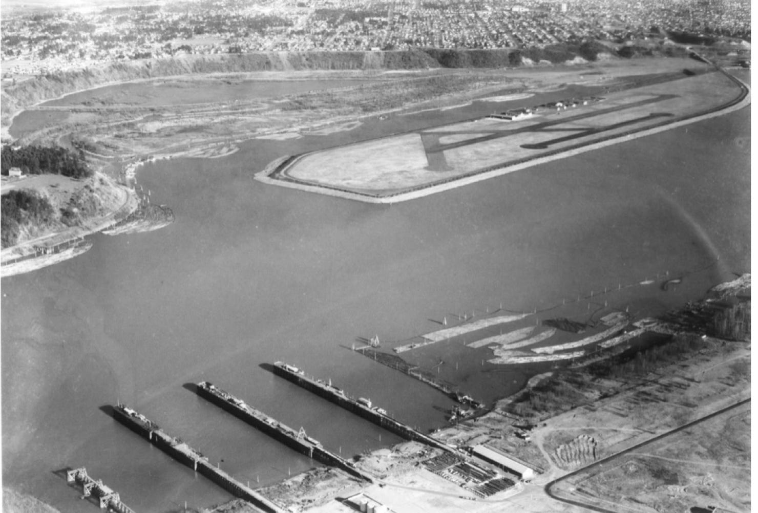
Swan Island airport on Willamette River circa 1930. It opened in 1927.
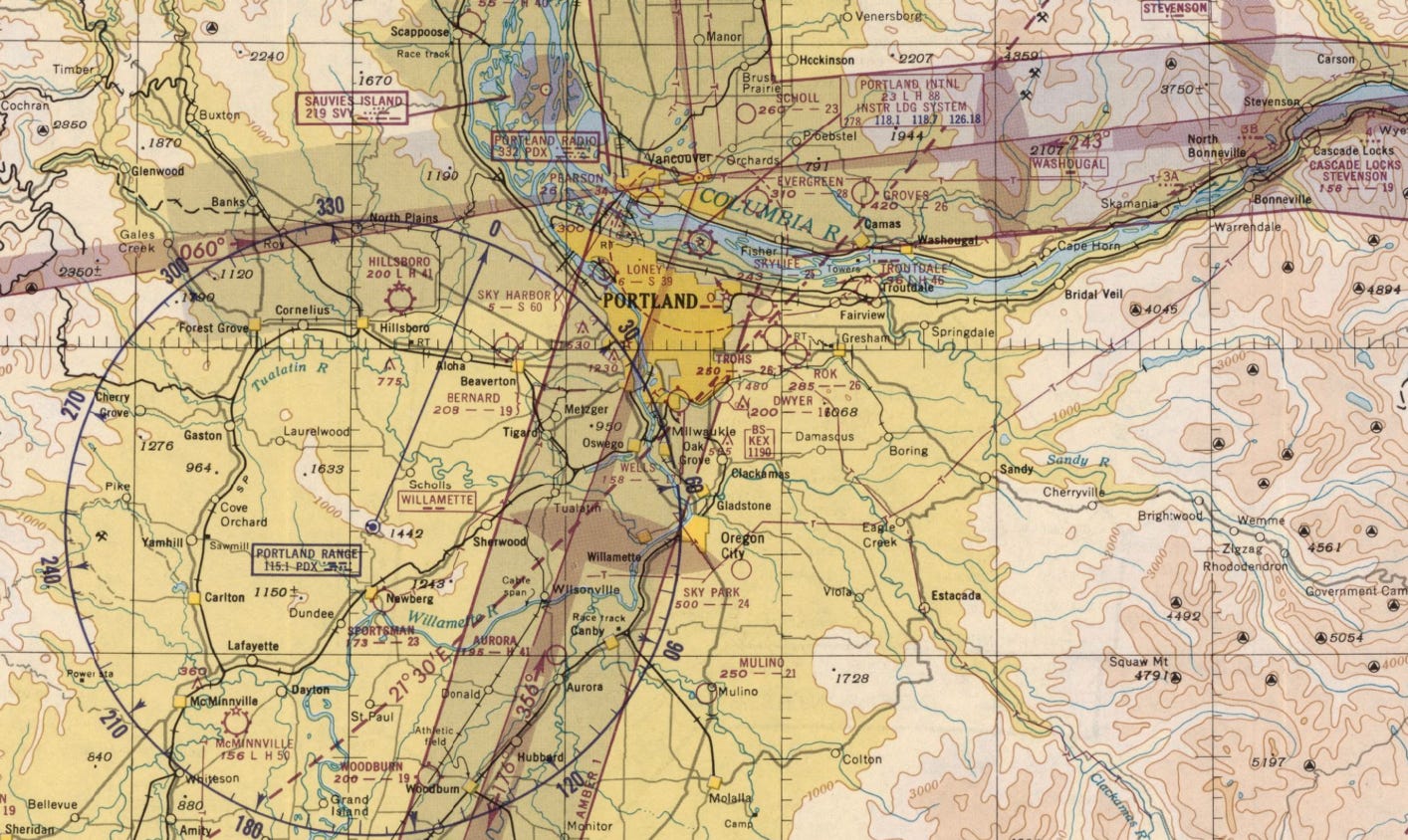
January 1939 – Portland Sectional
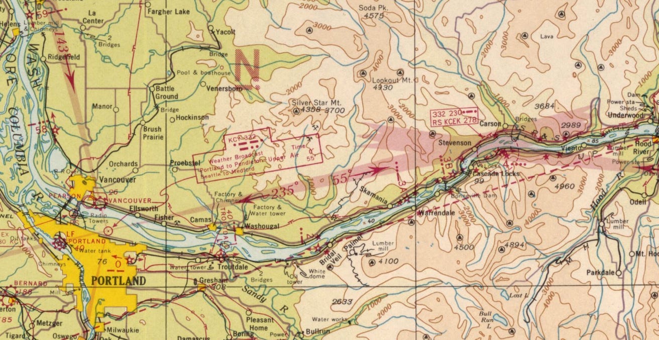
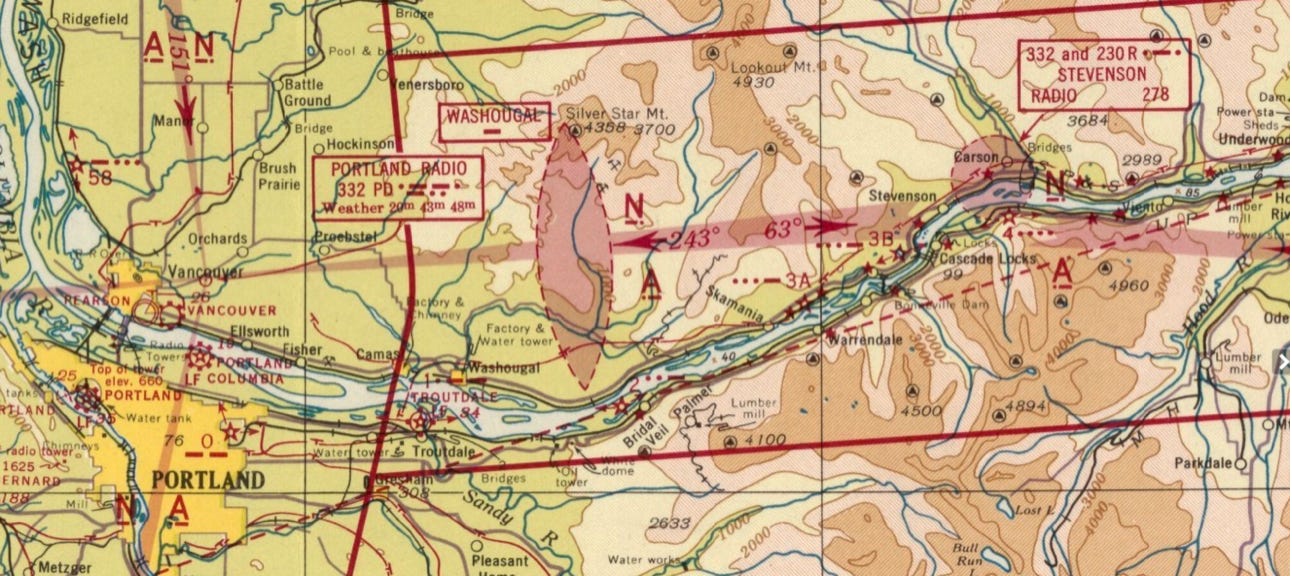
The radio beacon at Anderson Point (east of Cascade Locks) has been decommissioned and a new radio beacon has been installed across the river at Uncle Ted’s location. The probable reason for this was the relocating of the Portland range from the site of the new Portland airport a few miles north to Vancouver, thus shifting the course changeover point a few miles north. This shows both the old Portland Swan Island airport on the Willamette River and the new airport labeled PORTLAND COLUMBIA. The west pointing arrow on the Rocky Butte airway light beacon has been shifted to point to the new airport. The “PD” Portland range has moved to Vancouver (near the intersection of Fourth Plain and Andresen Roads) and the inbound course has shifted from 235 degrees to 243, thus the intersection point of the two “beam” courses has shifted north. “STEVENSON RADIO 278” Kc has been added, RADIO signifying the ability for pilots to contact a CAB Flight Service Station for position reports or weather updates. (A curiosity is that 278 Kc is also the Portland tower frequency prior to VHF.) The WASHOUGAL 75 Mhz / 100 watt electronic “fan marker” has been added to provide a fix along the airway notifying the pilot of a descent point when clear of the higher terrain. The “intermediate airport” at Anderson Point east of Cascade Locks is no longer portrayed.
When growing up, we lived in Vancouver overlooking the Columbia River and slightly west of the Portland airport. Not only could I monitor the airport activity, something which no doubt influenced my wanting to fly, but the airway light at Rocky Butte, a rotating white beacon followed by a red flashing Morse “M” _ _ was active until I left home in the early 1970s. The flash was bright enough to illuminate my bedroom wall! I thought it was just an obstruction light marking the 613’ MSL butte near PDX. It wasn’t until much later that I understood its significance and that it was likely the last operating remnant of the original airway light system in the area.
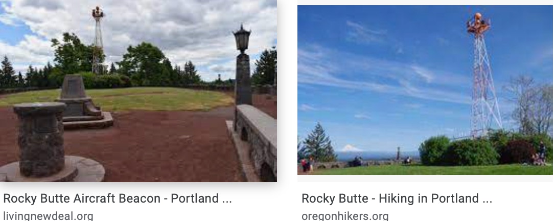
“A revolving beacon atop a metal tower at the summit contains a medium intensity white light that flashes intermittently. The tower also bore a red beacon that was discontinued in the late 1970s. The beacon was erected in 1933 by the U.S. Bureau of Lighthouses for aircraft navigation.”
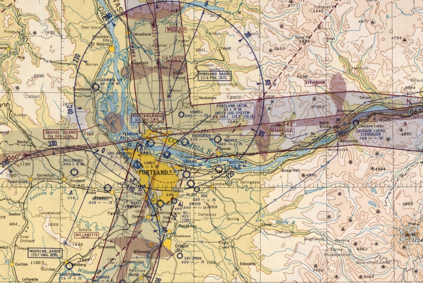
By July 1942 the beacon at Ted’s Rock has been relabeled STEVENSON RADIO and a Non-Directional Beacon “LZ” on frequency 347 kc had been installed. The green “side light” has been eliminated and the mile marker no longer shows. The light across from it, east of Cascade Locks, shows only #4 and the Morse letter “H.” Lights #3A and #3B at Beacon Rock and Wauna Lake are still portrayed. Note the subtle differences in the Columbia River after Bonneville Dam had raised the water level by 70 feet in that area. The mid-stream islands have disappeared.

By April 1947 the beacon at “Ted’s Rock” has been deactivated and instead the intersection of the Red 1 airway has been marked by the additional STEVENSON airway marker, followed further west by the WASHOUGAL airway marker. Each of these would indicate to pilots a stepdown fix approaching Portland. For those familiar with Evergreen airport, east of Vancouver, here it’s labeled SUGG, after Roy Sugg who developed the field in 1940 and later sold it to Wally Olson. (Sugg’s grandson Tom Craig and I were buddies in school.) Airway lights on Beacon Rock and Wauna Lake are still shown. Note the airway markers at La Center and north of Woodland for flights arriving into Portland from the north, also marking stepdown points clear of high terrain.
Until the following edition, Venersborg, a small community east of Battle Ground, has consistently been misspelled as Venersboro.

October 1949. Portland “Omni” Range portrayed just east of Hillsboro without azimuth.
October 1950. The Portland “Range” has relocated further south.
March 1950. The Portland “Range” is portrayed east of Hillsboro with azimuth.
October 1951. The Portland “Range” has moved to its current location near Battle Ground. The previous location has become the Newberg VOR.
October 1958. The Portland VOR shows up at its current location near Battle Ground. Years later it would be renamed BATTLEGROUND (BTG) to avoid confusion with PDX, the Portland Airport. A Military Climb Corridor is shown east of PDX to accommodate rapid climbs by F-102 fighters then based there. Sugg airport was renamed EVERGREEN in 1948. That’s where I learned to fly in the 1960s.
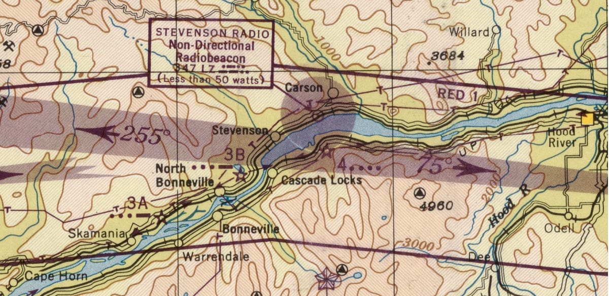
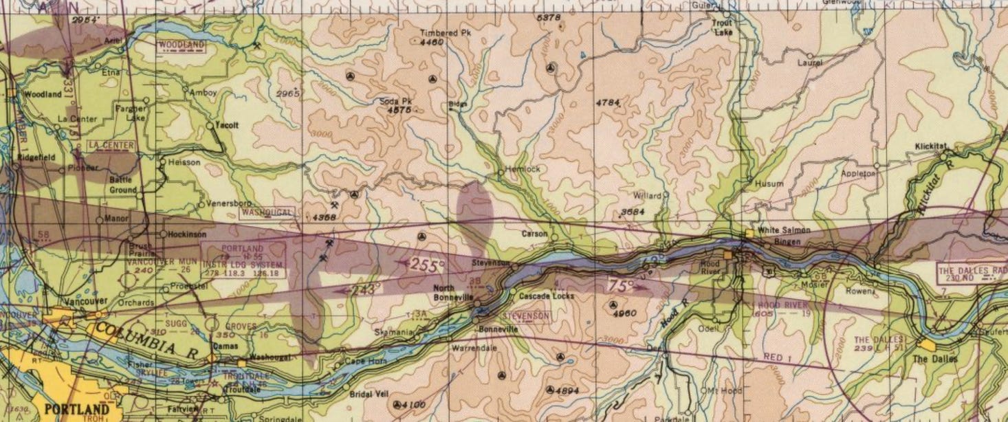
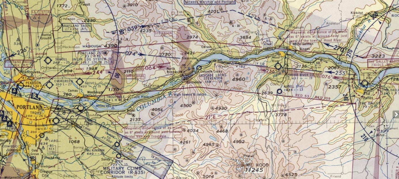
By July 1967 the only airway light remaining in the Columbia Gorge is #3B just east of North Bonneville at Wauna Lake. The four-course radio ranges at The Dalles and Portland have been retired and replaced by VORs and “Victor” airways, shown here as V-182 / V-112. After this edition the only original airway light remaining in commission was on Rocky Butte.
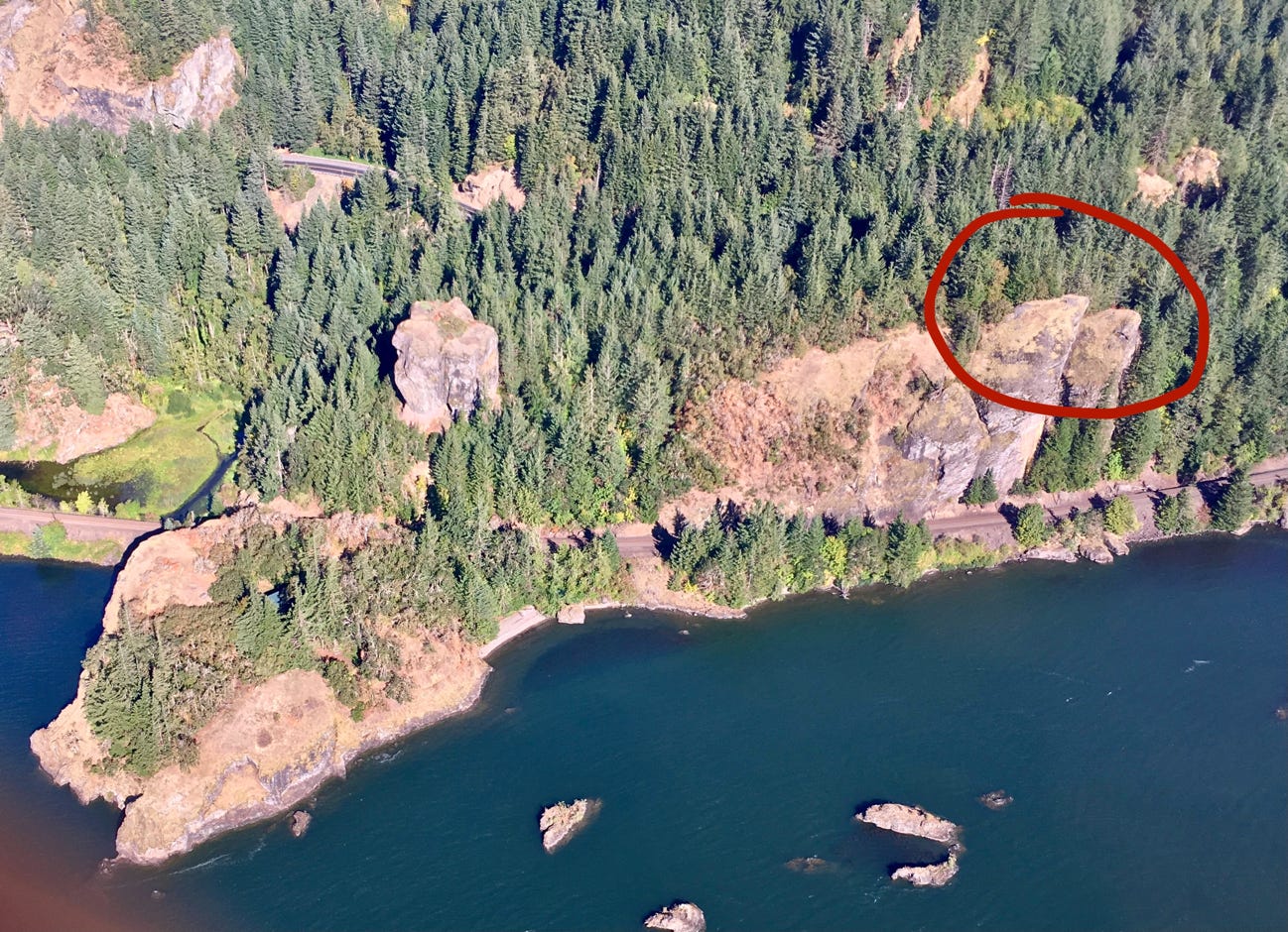
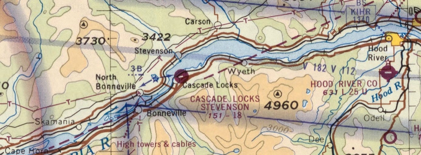
Red circle marks the location of the original green airway “side light” and subsequent radio mast at Uncle Ted’s place. The S, P & S railroad is now the BNSF. SR-14 highway at top. At lower left, the green roof of Uncle Ted’s home can be seen.
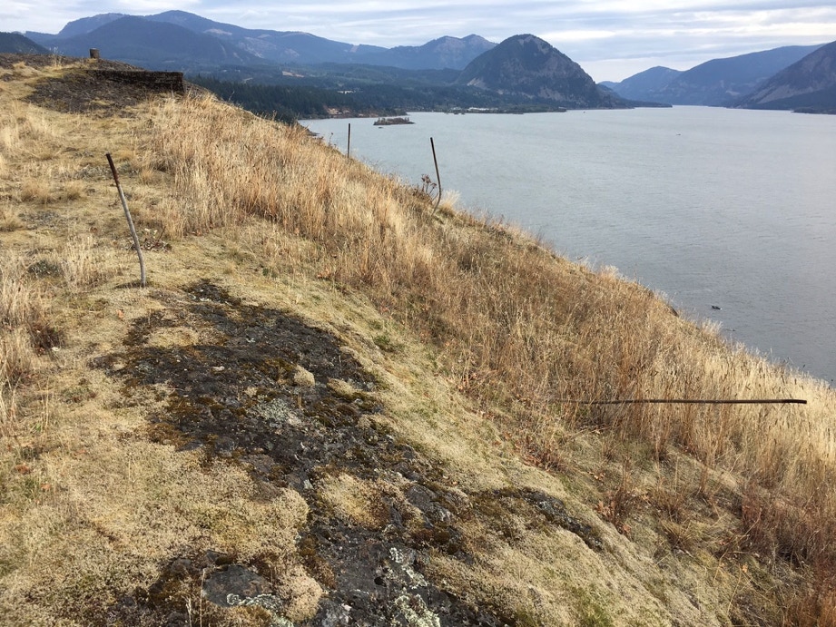
A few remains from the wooden “tower.” 100 feet north of here is a concrete foundation which likely housed radio equipment for the radio beacon. Locals sometime refer to this spot as “Weather Station Rock.” It’s unknown whether a weather observer occupied the building. Wind Mountain in the distance looking east. It’s a spectacular location. I spread both my mother’s and brother’s ashes here. In each case the blustery east winds assured that few ashes remained nearby.
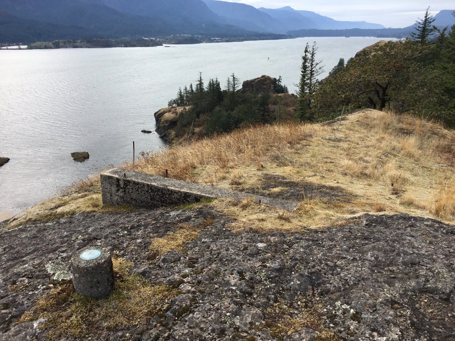
On the ground at that location.
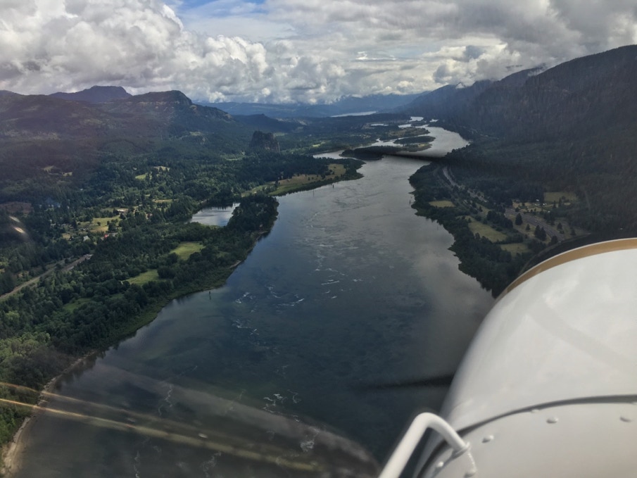
Flying the Gorge just west of Beacon Rock
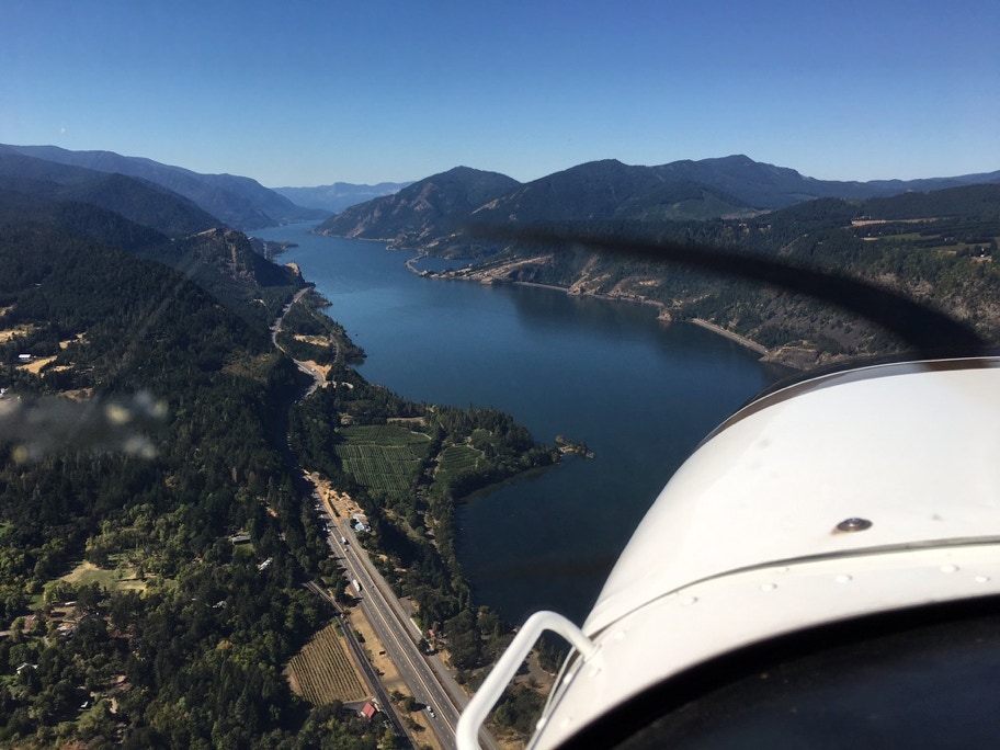
Looking west, five miles east of Wind Mountain
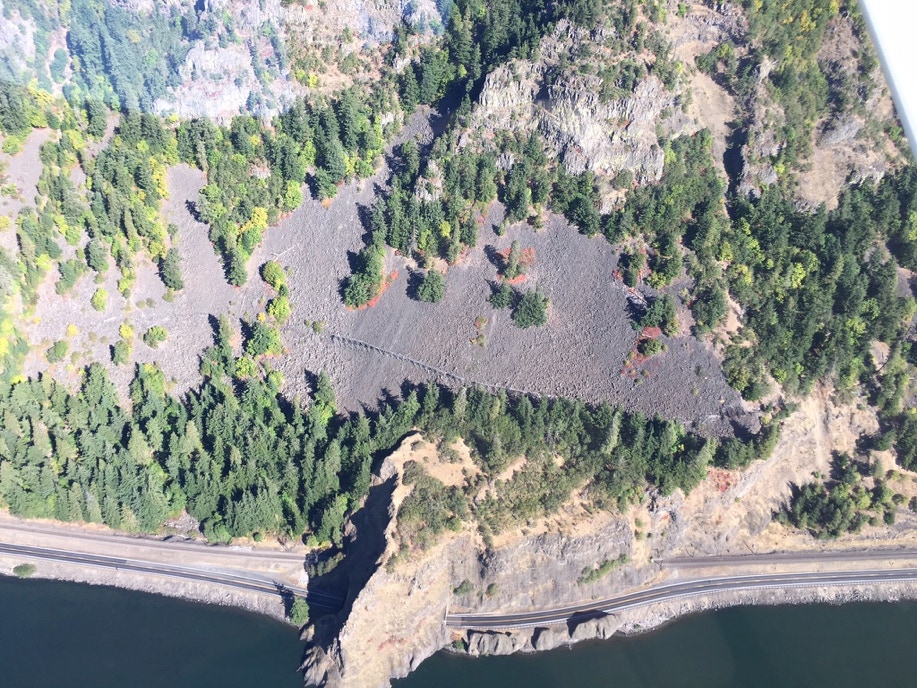
Remnant of the Willard-Broughton flume